
Urban site plan rendering for city planning operates as a translation layer between technical planning documents and public comprehension: by converting zoning data, massing studies, GIS context, and circulation networks into spatially accurate, photorealistic aerial and street-level visualizations, planners transform complex proposals into a nontechnical visual language that residents, elected officials, and community stakeholders can evaluate directly. Because planning boards and the general public assess proposals visually rather than parsing two-dimensional plats and density tables, a precise 3D rendering pre-empts the questions that drive public opposition – building height relative to the neighborhood, shadow impact, setback distances, and integration with existing streetscapes. Across consultation hearings, design charrettes, and digital engagement portals, visualization measurably increases participation, accelerates consensus, and reduces the costly delays that derail development approvals. For planning departments and the consultants who serve them, rendering has shifted from a presentation flourish to essential civic infrastructure.
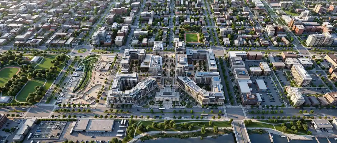
The gap between a proposal that wins community support and one that collapses under public objection often comes down to a single factor: whether residents can actually picture what is being proposed. Partnering with a dedicated 3D site plan rendering company gives planning teams a photorealistic, contextually accurate visualization that translates abstract zoning concepts into the visual language non-experts understand immediately and respond to constructively.
Why Public Communication is the Hardest Part of Urban Planning
Urban planning is fundamentally a public process. Unlike private development decisions, planning proposals must navigate community meetings, public hearings, and stakeholder consultations where ordinary residents – not technical experts – hold real influence over outcomes.
This creates a persistent communication challenge. Planners work in a technical language of floor-area ratios, setback requirements, density gradients, and zoning overlays. The public, however, experiences the city through lived, visual, spatial reality.
When these two languages collide at a public hearing, the result is often confusion, suspicion, and opposition. As research published in the National Academies’ guidance on visualization for public involvement notes, interactive 3D environments provide viewers with an experiential dimension that dramatically enhances public understanding of design concepts.
The core problem is straightforward: people cannot support, or even meaningfully evaluate, what they cannot picture.
Consider how a typical resident encounters a development proposal:
- A 2D site plan covered in technical annotations
- A zoning amendment described in legal and regulatory language
- A density figure expressed as units per acre
- A massing diagram showing abstract gray blocks
None of these communicate what the resident actually wants to know: What will this look like from my street? How tall is it next to my home? Will it cast shadows on the park? Does it fit the character of my neighborhood?
Urban site plan rendering for city planning answers exactly these questions, in exactly the form residents need.
What Urban Site Plan Rendering Communicates to the Public
A 3D site plan rendering is a spatially accurate, photorealistic visualization of a proposed development shown within its real urban context. For public communication specifically, it conveys the lived experience of a proposal in ways no technical document can.
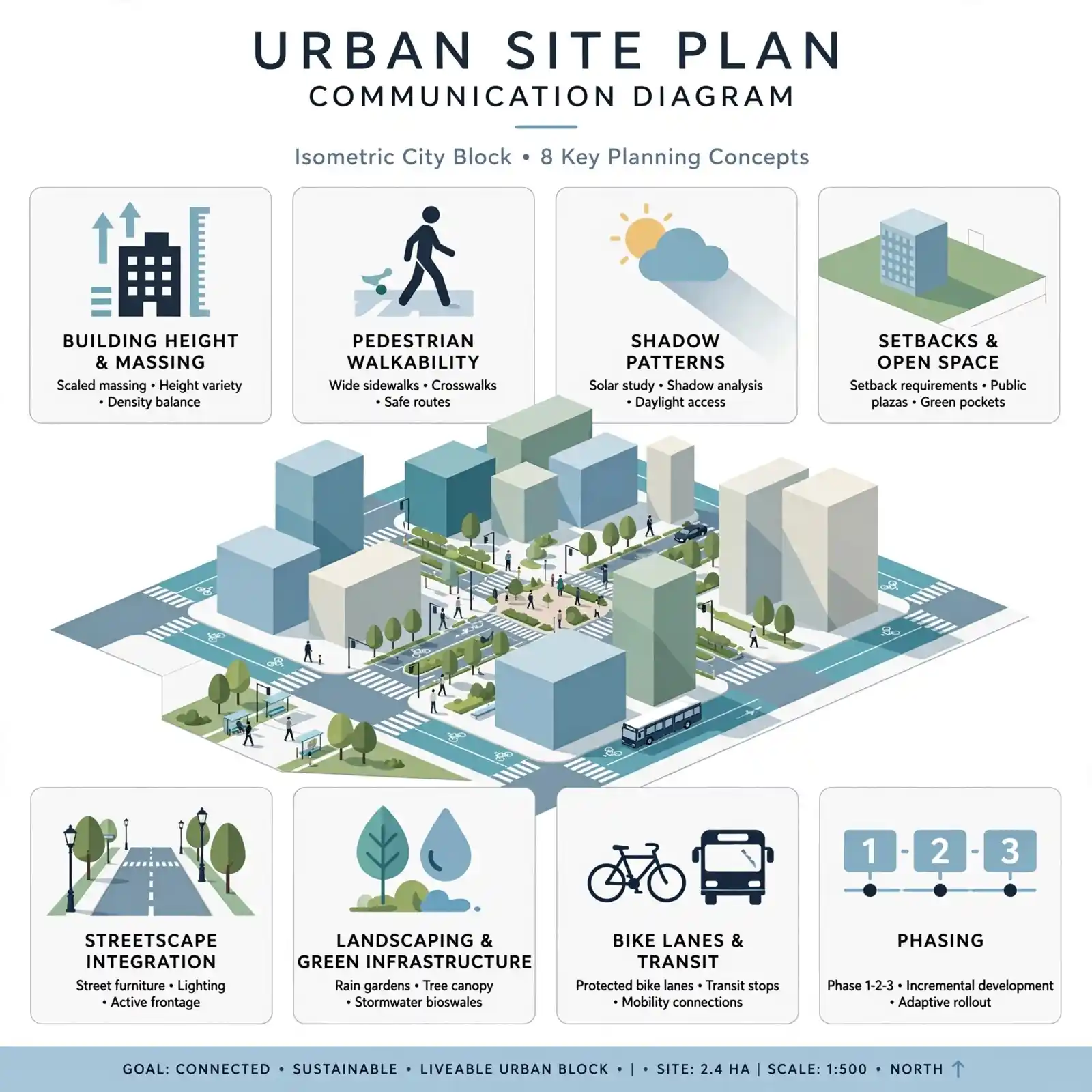
A professional urban planning rendering communicates:
- Building height and massing relative to existing neighboring structures
- Street-level pedestrian experience and walkability
- Shadow patterns and their effect on public spaces at different times of day
- Setbacks, building separation, and open space distribution
- Integration of the proposal with the existing streetscape and skyline
- Landscaping, public realm improvements, and green infrastructure
- Transportation connections, bike lanes, and transit access
- Phasing of large developments over time
According to GIS specialists at Esri, whose 3D mapping tools support planning sessions, three-dimensional models translate complex spatial data into a visual, nontechnical language that enables genuine public participation. This translation is the entire point.
For readers who want a deeper understanding of how technical site data becomes a photorealistic visualization, the detailed primer on what a 3D site plan rendering actually is explains the full process and visual scope.
The Five Ways Urban Planners Use Renderings to Build Public Support
1. Demystifying Complex Proposals at Public Hearings
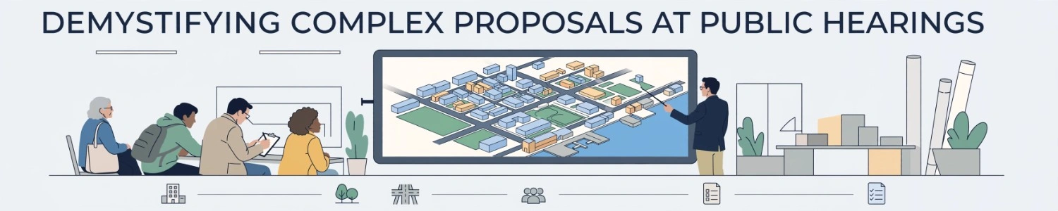
Public hearings are where development proposals live or die. Residents arrive with concerns, and planners have limited time to address them. A rendering displayed at the hearing immediately answers the spatial questions that generate the most anxiety.
When residents see an accurate visualization showing the proposed building at its real height, next to their familiar streetscape, abstract fears about “a massive tower” often dissolve into informed, specific feedback. The conversation shifts from emotional opposition to constructive dialogue.
2. Enabling Meaningful Community Engagement and Co-Design

Modern planning emphasizes participatory design, where communities help shape proposals rather than simply approving or rejecting them. Renderings make genuine co-design possible.
When residents can see multiple design alternatives rendered side by side, they can offer specific, actionable feedback:
- “The version with the setback park works better for our block”
- “The taller, narrower option preserves more open space”
- “The materials in option two fit our neighborhood character”
This kind of informed participation is impossible with technical drawings alone. Visualization gives every stakeholder, regardless of technical background, an equal seat at the design table.
3. Reducing Public Opposition and NIMBY Resistance
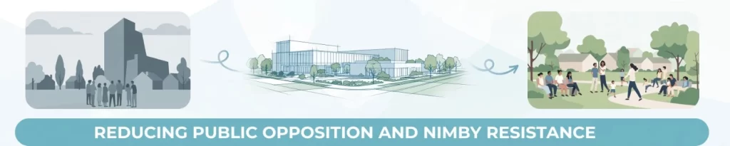
Much public opposition to development stems from uncertainty rather than genuine objection. People fear what they cannot see, and they imagine the worst-case scenario when given only abstract information.
A clear, honest rendering replaces worst-case imagination with accurate reality. When the actual proposal is less intrusive than residents feared – which is frequently the case – the rendering itself becomes the most effective tool for reducing opposition. Research from MIT on interactive planning tools highlights that visualization, personalization, and immediate feedback together transform public resistance into engagement.
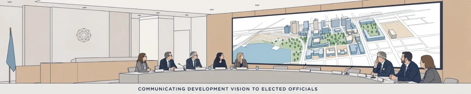
4. Communicating Development Vision to Elected Officials

City councils, county commissions, and planning boards make the final decisions on most major developments. These elected officials are generalists, not design professionals, and they answer to constituents.
A compelling rendering gives elected officials two critical things: a clear understanding of what they are approving, and a visual asset they can use to explain and defend their decision to the public. This dual function makes renderings invaluable in the political dimension of planning.
5. Powering Digital Engagement and E-Participation
Public participation increasingly happens online through engagement portals, virtual open houses, and interactive web platforms. Renderings are the visual backbone of these digital tools.
A resident who cannot attend an evening hearing can review a rendering online, understand the proposal, and submit informed feedback from home. This expands participation dramatically, reaching residents who are typically excluded from traditional in-person processes – working parents, shift workers, people with mobility limitations, and younger residents.
How Rendering Compares to Traditional Planning Communication Tools
| Communication Tool | Public Comprehension | Engagement Level | Production Effort | Best Use Case |
|---|---|---|---|---|
| 2D site plans | Low – requires technical literacy | Passive | Low | Regulatory submission |
| Zoning text and tables | Very low for non-experts | Minimal | Low | Legal documentation |
| Physical scale models | Moderate to high | Moderate | High and costly | Single fixed viewpoint |
| 3D site plan renderings | High – immediate and intuitive | Active | Moderate | Public hearings and engagement |
| Interactive 3D / VR models | Very high – immersive | Highly active | High | Co-design charrettes |
The pattern is clear. While 2D plans and zoning text remain essential for regulatory and legal purposes, they fail at public communication. Renderings occupy the sweet spot: high comprehension and strong engagement at a reasonable production effort.
Practical Insights: What Makes a Planning Rendering Effective for the Public
Not every rendering serves public communication well. An effective urban planning rendering has specific qualities that distinguish it from a developer’s marketing image.
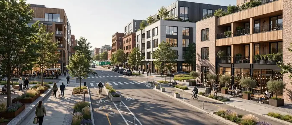
An effective public-facing planning rendering must be:
Contextually honest
Neighboring buildings, streets, and landmarks must be modeled accurately to scale, not idealized or removed
Spatially accurate
Building heights, setbacks, and distances must match the actual proposal precisely
Multi-perspective
It should include aerial context views and pedestrian eye-level views, because the public experiences cities from the ground
Time-aware
Shadow studies and different times of day address common public concerns about light and overshadowing
Neutral and credible
Overly glamorized renderings erode public trust; accurate, balanced visualizations build it
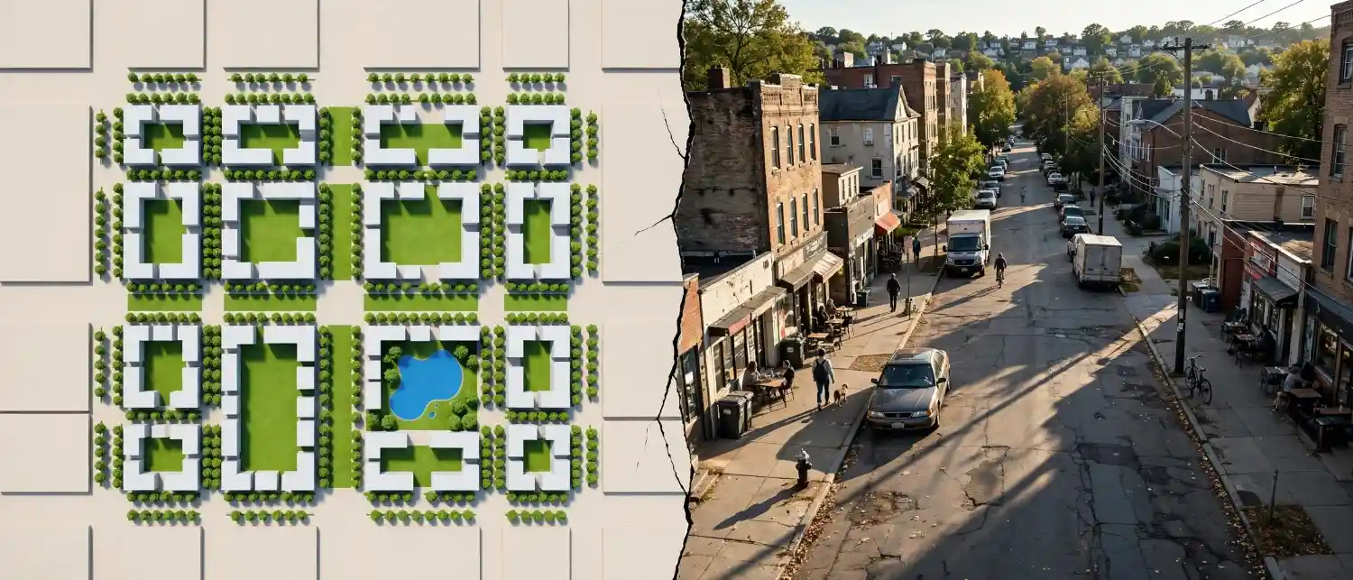
The credibility dimension matters enormously in public planning. Unlike private marketing, where idealization is expected, public planning renderings carry an implicit promise of accuracy. A rendering that overstates landscaping, understates building bulk, or hides negative impacts will be discovered, and that discovery destroys trust in the entire planning process.
Common Mistakes Planners Make With Public Renderings
Even experienced planning teams undermine their public communication with avoidable rendering errors. These are the most damaging ones:
Producing Misleadingly Idealized Renderings
The single most damaging mistake is creating renderings that overstate the proposal: lush landscaping that will never be maintained, perpetually sunny skies, no traffic, and impossibly happy crowds. When the public senses manipulation, it poisons trust in the entire process and fuels opposition.
Showing Only Aerial Views
Aerial views communicate site organization, but the public experiences cities at eye level. A planning presentation that shows only bird’s-eye perspectives fails to answer the question residents care about most: what will this look like from my sidewalk?
Ignoring Shadow and Overshadowing Studies
Light and shadow are among the most common public concerns, especially for taller buildings near homes, parks, and schools. Renderings that omit shadow studies leave this anxiety unaddressed, allowing opposition to fill the gap with worst-case assumptions.
Removing or Simplifying the Existing Context
A rendering that places the proposal on a blank or simplified site fails the public credibility test. Residents know their neighborhood. When the familiar context is missing or wrong, they immediately distrust the visualization.
Commissioning Renderings Too Late in the Process
Planners who produce renderings only after opposition has already mobilized are fighting uphill. The rendering should be ready before the first public meeting, when it can shape first impressions rather than react to entrenched objections.
Expert Tips: Maximizing Public Trust With Urban Planning Renderings
Tip 1: Lead With Eye-Level Views, Support With Aerials
Open public presentations with pedestrian-perspective renderings that show the lived experience of the proposal. Follow with aerial context views that explain site organization. This sequence mirrors how the public actually experiences and evaluates urban space.
Tip 2: Always Include Honest Context
Model the real neighboring buildings, the actual street network, and existing landmarks accurately. A rendering that residents can verify against their own knowledge of the area builds credibility that carries through the entire engagement process.
Tip 3: Show Shadow Studies Proactively
Do not wait for the public to raise shadow concerns. Present shadow studies for morning, midday, and afternoon as part of the initial presentation. Addressing concerns before they are voiced signals transparency and good faith.
Tip 4: Present Multiple Alternatives When Possible
Showing two or three rendered design options transforms the public from critics into collaborators. People who help choose a direction feel ownership of the outcome and become advocates rather than opponents.
Tip 5: Make Renderings Accessible Online
Post renderings on the project’s engagement portal, in virtual open houses, and on social media. Digital access dramatically expands participation beyond those who can attend evening hearings, producing more representative community input.
Tip 6: Pair Renderings With Plain-Language Explanation
A rendering communicates the visual, but pair it with clear, jargon-free text that explains what the public is seeing. Effective visualizations make technical concepts like zoning and density tangible to non-experts, but a brief explanation amplifies that effect.
Step-by-Step: Integrating Renderings Into the Public Engagement Process
Follow this sequence to deploy renderings at the highest-impact points in the planning communication process:
Step 1: Prepare Accurate Base Data
Gather the site survey, GIS context data, zoning parameters, and the proposed massing or design. Ensure the surrounding context is accurately mapped.
Step 2: Commission Renderings Before the First Public Meeting
Brief your rendering studio early, ideally as soon as the proposal reaches schematic design. Allow time to produce a coordinated set of views before public engagement begins.
Step 3: Develop a Coordinated View Set
Produce eye-level pedestrian views from key public vantage points, aerial context views, and shadow studies. For larger projects, add phasing visualizations.
Step 4: Build Renderings Into Every Engagement Channel
Integrate the renderings into hearing presentations, printed materials, the project website, virtual open houses, and social media engagement.
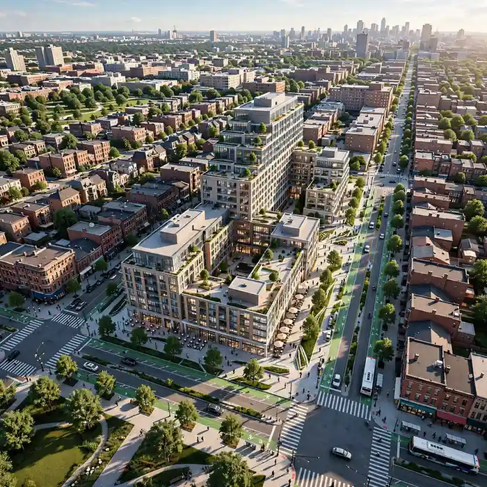
Step 5: Present With Honesty and Context
Lead public presentations with the renderings, explain what residents are seeing in plain language, and invite specific feedback on the visualized proposal.
Step 6: Update Renderings as the Design Responds to Feedback
When the proposal changes in response to public input, update the renderings to reflect those changes. This shows the community that their participation produced tangible results, reinforcing trust in the process.
Frequently Asked Questions: Urban Site Plan Rendering for City Planning
Q: What is urban site plan rendering for city planning?
Urban site plan rendering for city planning is the process of converting zoning data, massing studies, GIS context, and design proposals into spatially accurate, photorealistic 3D visualizations. These renderings show proposed developments within their real urban context, communicating building height, streetscape integration, shadow impact, and public realm improvements in a visual language that residents, officials, and stakeholders can understand without technical training.
Q: How do 3D renderings help reduce public opposition to development?
Much public opposition stems from uncertainty rather than genuine objection. When residents are given only abstract information, they tend to imagine worst-case scenarios. An honest, accurate rendering replaces that imagination with reality. Because the actual proposal is frequently less intrusive than residents feared, the rendering itself becomes the most effective tool for converting opposition into informed, constructive feedback.
Q: Why are renderings better than 2D plans for public communication?
2D plans require technical literacy that most residents do not have. Renderings communicate the lived, spatial experience of a proposal directly and intuitively. While 2D plans and zoning text remain essential for regulatory and legal purposes, renderings achieve far higher public comprehension and engagement, which is exactly what the public communication stage of planning requires.
Q: What views should an urban planning rendering include?
An effective planning rendering set should include pedestrian eye-level views from key public vantage points, aerial context views showing site organization, and shadow studies at different times of day. For larger or phased developments, phasing visualizations showing how the project develops over time are also valuable.
Q: Can renderings be used for online public engagement?
Yes, and this is one of their most valuable applications. Renderings are the visual backbone of digital engagement portals, virtual open houses, and interactive web platforms. They allow residents who cannot attend in-person hearings – working parents, shift workers, and people with mobility limitations – to review proposals and submit informed feedback online, producing more representative community input.
Q: How accurate do urban planning renderings need to be?
For public planning, renderings must be highly accurate and contextually honest. Building heights, setbacks, and distances must match the actual proposal, and neighboring context must be modeled correctly to scale. Unlike private marketing, public planning renderings carry an implicit promise of accuracy. Misleading or idealized renderings, once discovered, destroy public trust in the entire planning process.
Q: When in the planning process should renderings be created?
Renderings should be ready before the first public meeting, ideally as soon as the proposal reaches schematic design. Early renderings shape first impressions and frame the public conversation constructively. Renderings produced reactively, after opposition has already mobilized, are far less effective at building support.
Q: Do urban planning renderings replace public consultation?
No. Renderings are a tool that makes public consultation more effective, not a replacement for it. They give residents the visual understanding they need to participate meaningfully, but genuine engagement still requires open dialogue, responsiveness to feedback, and a willingness to adjust proposals based on community input.
Conclusion: Visualization Is the Language of Public Planning
In urban planning, the best proposal does not always win. The proposal that the public can understand, evaluate, and support is the one that moves forward.
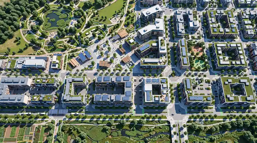
Urban site plan rendering for city planning has become the essential bridge between the technical world of planners and the lived, visual world of the communities they serve. It demystifies complex proposals at public hearings, enables genuine community co-design, reduces opposition rooted in uncertainty, equips elected officials to make and defend decisions, and powers the digital engagement that brings more voices into the process.
The planners who consistently build public support and move projects through approval are not necessarily those with the most ambitious visions. They are the ones who give every resident, official, and stakeholder a clear, honest, and compelling visual answer to the fundamental question every community asks: what will this actually look like in our neighborhood?
Ready to turn complex development proposals into visuals your community understands and supports? and give every public stakeholder a clear, accurate view of what your project will mean for their city.