
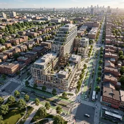
How Urban Planners Use 3D Site Plan Rendering for City Planning?
Urban site plan rendering for city planning operates as a translation layer between technical planning documents and public comprehension: by converting zoning data, massing studies, GIS context, and circulation networks into spatially accurate, photorealistic aerial and street-level visualizations, planners transform complex proposals into a nontechnical visual language that residents, elected officials, and community stakeholders can[…]